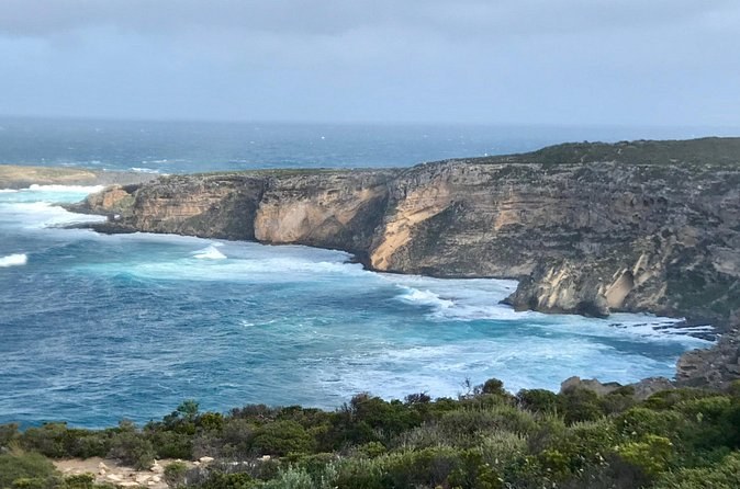
Kangaroo Island Small‑Group Scenic & Wildlife Day Tour
A whole day from Kingscote with eleven guests at most, park fees and a cafe lunch in the far west included.
From $292 per person (minimum 1)
Check AvailabilityThe island is about 155 km long and up to 55 km wide, and the tours start in very different places. The boats leave from one town, the dune rides from another coast, and the full days from hotels in a third. Use this map to see where your Kangaroo Island booking begins and how far the drive is.
Most people underestimate the drives. Before you book, find your tour's start in this table and check it against where you sleep.
| Where you start | Address | What starts there |
|---|---|---|
| Adelaide | Central Bus Station, 85 Franklin Street, or a city hotel | The 2-day and 3-day trips |
| Penneshaw marina | Christmas Cove Marina, and 43 Howard Drive opposite | Both dolphin and seal boats |
| Penneshaw cruise landing | The tender landing; buses on North Terrace | Both cruise shore days |
| Kingscote | Hotels, the Ozone Hotel, Dauncey Street, the airport | Most full days and both night tours |
| American River | Hotel pickup | The 4WD days and the coach day |
| Vivonne Bay, Jetty Road | 188 Jetty Road | The quad bikes |
| Vivonne Bay, South Coast Road | 3733 South Coast Road | The buggy, the e-fatbikes and the koala walk |
The Vivonne Bay bases are the ones that surprise people. They are on the south coast, about 90 minutes from the ferry, and none of them runs a shuttle. If you have no car, those tours are out of reach.
Match the tour to where you sleep: the full days collect in Kingscote and American River, the boats leave Penneshaw.
These are the distances the parks service and the tourism bodies give. A full day to the west spends several hours on the road for that reason.
| From | To | Distance or time |
|---|---|---|
| Adelaide | The ferry port | About 1.5 hours by road |
| The ferry port | Penneshaw | 45 minutes by ferry |
| Adelaide | Kingscote | About 30 minutes by air |
| Kingscote | The sea lion colony | About 45 minutes by road |
| Kingscote | The far-west park | About 110 km |
| Adelaide | The far-west park | 266.4 km |
| Penneshaw | The Vivonne Bay bases | About 90 minutes by road |
| Kingscote | The north-coast campground at the cave beach | About 38 km west |
Fuel shapes a long day as much as distance. There is 24-hour fuel at Kingscote, Penneshaw, American River and the Western KI Caravan Park, and more at Parndana and Vivonne Bay. Fill up before you head west, because the national park has none.
Backstairs Passage, the strait the ferry crosses, is about 15 km wide. On the island, there is no public transport and no taxi, so the distance between your bed and your tour start is yours to cover.
Kangaroo Island Tourism divides the island into regions, and they are the easiest way to read the map.
Cape Willoughby is the lightstation at the east tip. Stokes Bay is the beach you reach through a cave. Little Sahara is the dune field the activity bases sit beside. Seal Bay and Flinders Chase are the parks that most tours visit, with Remarkable Rocks and Admirals Arch inside the second.
The map opens on the middle of the island. Zoom east for Penneshaw and west for the national park.
The island, from the ferry port to the west end
Penneshaw, Kingscote,
Vivonne Bay and the parks
Nothing is loaded from Google until you press it.
Phone signal fades as you go west, so save the map offline before you leave town. Telstra gives the widest coverage.
The ferry shuttle runs between Penneshaw and Kingscote around the morning and evening boats. Beyond that, a tour with pickup is your transport. The coach day collects in Penneshaw, Kingscote and American River, and the 4WD days collect in Kingscote and American River.
If you are staying at Vivonne Bay or in the west, you will need a car or an operator willing to collect you. Ask before you book.
So choose your bed by your tour. Stay in Kingscote or American River for the 4WD days and the night tours, which collect there. Stay in Penneshaw for the boats and an easy ferry. If the dunes are your main reason for coming, stay on the south coast with a car, because the activity bases are a long way from both towns.
The distances are the parks service's, Kangaroo Island Tourism's and the South Australian Tourism Commission's, read 24 September 2026. Every start address comes from the tour's own listing, saved on 24 September 2026.
A whole day from Kingscote with eleven guests at most, park fees and a cafe lunch in the far west included.
From $292 per person (minimum 1)
Check Availability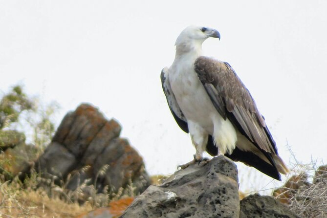
Seventy-five minutes by boat from Penneshaw looking for dolphins, seals and sea eagles; the fare cannot be refunded.
From $62 per person (minimum 2)
Check Availability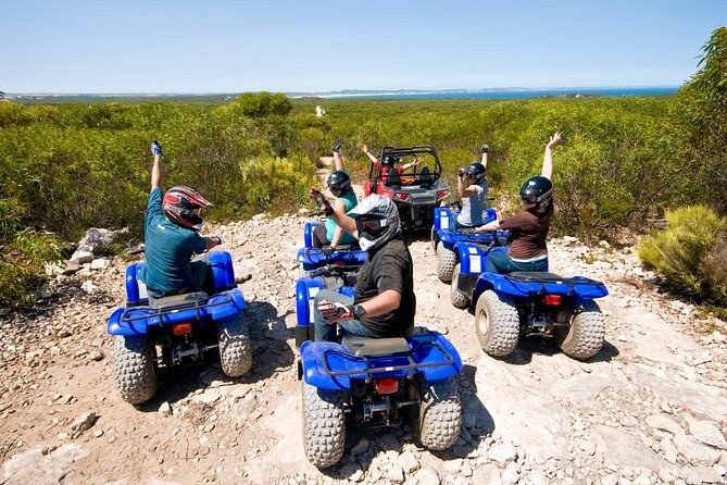
Ride your own quad through bush and sand at Vivonne Bay with six riders at most; drivers from 6, passengers from 4.
From $140 per person (minimum 1)
Check AvailabilityNext: plan the crossing with the ferry and flights, see what each coast offers, or compare every fare on Kangaroo Island Tours.